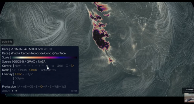
Around 3 O’clock on the 24th of Feburary, and since then, high levels of both carbon monoxide, and sulfur dioxide have been detected and present over California.
What is odd is that on the 29th New Zealand experienced an earth quake with similar CO2, and SO2 levels above the location right before the quake.
Although high levels of CO2 can cause an earthquake, the shake would be rather small, but of course this is California, and there lies one of the biggest fault lines of them all making the potential of having a tiny earthquake into catastrophic one.
On the next page, in one of the videos below, images of the CO2 and SO2 density can be seen over California, and worst of all in the other video, it is shown how NASA has hid these images.
Read more on page two, and find out exactly how NASA is lying.

*Is someone able to show to copy the images and paste them into here, and which ones I am allowed to use. I’d like to learn so that I can do it myself, Thanks:)*
I use a program called Jing. Works great for quick screen captures and videos: https://www.techsmith.com/jing.html
Could this have anything to do with the methane gas leak in Southern California?
Mike Shope
Don’t have clue
Well if you start feeling rumbles you might want to get out of Cali..
Don’t worry, Obomber’s EPA is on it!!
Ok, we fixed the methane gas leak in Californie. Now we have co2 and sulfur gasses. This sounds like something big this way comes. If I lived on the west coast I would take a vacation right now and head for the hills.
Um carbon monoxide is CO who every wrote this article needs to go back to school . Carbon dioxide is CO2
Dutch !!
Didn’t happen.