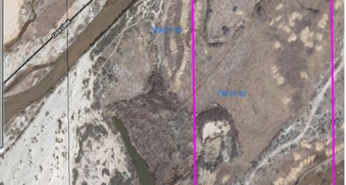
Harry Reid has run 52 ranchers out of business so far, just like their recent efforts with Cliven Bundy, because of his ownership in Reid Bunkerville, LLC, which holds 93 acres in Nevada.
The parcels seem to be in the way of future development with the Chinese, which may even involve a freeway interchange and loop, and all sit west of the same general area as the land where all these ‘trespassing cattle’ graze.
We all know that the Reid crime syndicate had ulterior motives for the attacks on Cliven Bundy. Here’s the proof.
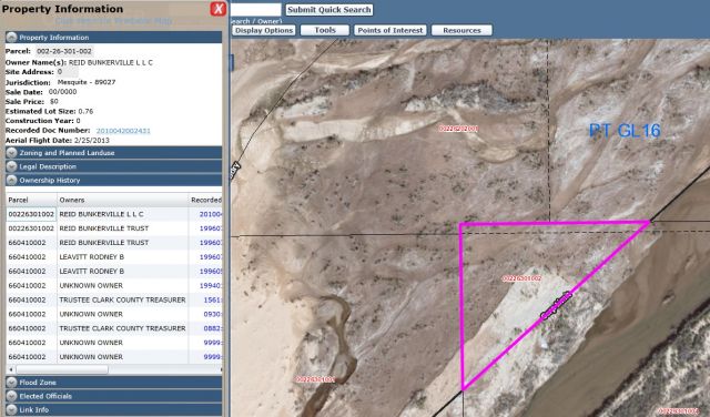
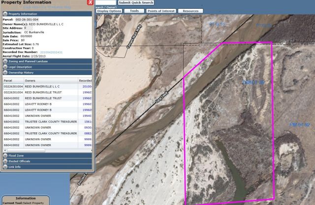
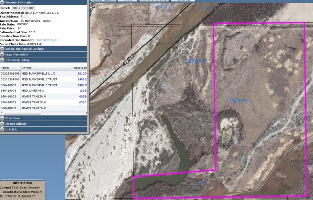
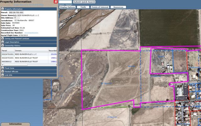
Below are the parcel numbers of land which the Clark County Assessors Office lists as owned by Reid Bunkerville, LLC, who coincidentally updated their company records on April 17, 2014. The parcel map with ownership data will be shown for the three parcels Reid Bunkerville, LLC owns, below the linked parcel numbers.
REID BUNKERVILLE L L C DST-901 #002-26-301-002
REID BUNKERVILLE L L C DST-800 #002-26-301-004
REID BUNKERVILLE L L C DST-800 #002-26-301-005
REID BUNKERVILLE L L C DST-800 #002-26-701-001
To put some of this into context and to provide readers a starting point on why parcels and ownership listings are not only important but should be researched extensively, please note that three of those four parcel numbers above are listed as Bunkerville jurisdiction, where Mr. Cliven Bundy’s ranch is located.
Parcels above and below are listed as owned by USA, jurisdiction listed as Mesquite, two examples of that shown below.
USA #002-26-202-001
USA #002-26-301-001
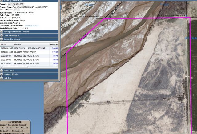
The last one listed above for Reid Bunkerville, LLC, (REID BUNKERVILLE L L C DST-800 #002-26-701-001) directly borders another parcel in Bunkerville, and shows the “owner” as Bureau of Land Management (BLM), not the USA as the examples above are.
REID BUNKERVILLE L L C DST-800 #002-26-701-001
BUREAU OF LAND MANAGEMENT #002-26-601-002
According to descriptions of the BLM, their job is to “administer” or “manage” public lands, yet they are listed as “owners” of the parcel directly connected to the Reid Bunkerville parcel.
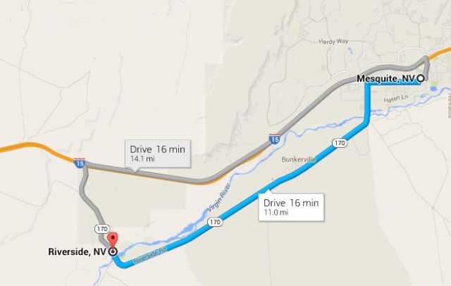
It is also noteworthy that a Google map from Mesquite Nevada, through Bunkerville, down to Riverside, goes up to a fully functional and built intersection that loops back around to Mesquite, shown in the image below.
Zoning and development are driven by “business loops”, which use high speed intersections from freeways that cost taxpayers millions of dollars. These can instantly raise property values for landowners in the right place who know where the development is going to happen. Decisions for the infrastructure are controlled by state and local and generally involve money from the federal government.
Below is a comprehensive report of properties owned by Reid Bunkerville Trust and Reid Bunkerville LLC, showing over 30 properties in the Bunkerville and Mesquite area.


Reid led corruption on Capitol Hill for many years. He is a disgrace to all Americans. We the People must see to it that TERM LIMITS are put in place NOW.
Reid is now serving life at Gitmo
He makes me sick to my stomach….When the Bundy ranch thing went down, it didn’t take long to see who was behind it all……He should be made to give it all back & not profit off the people while he is serving them…..It’s beyound disgusting.. give it all back Harry…clear your conscious… Your so call gains will never be a reward for you…do the right thing
Love the Judge, but harry reid is a scab on the ass of America. When he proudly confessed to making up lies about Romney to keep him out of the President’s office his reply was, “well he didn’t get elected did he”?
Federal government land grab and pure greed And Dumbo Greedy Clinton sold 20 percent of Americas Uranium to a Russian. Time to finish draining the swamp. These ranchers they ripped off need to sue for all they can get
F**e news about Harry! Trying to get attention off POTUS and all his shady dealings and family still doing business as usual and Ivanka and the rest. No to mention the POTUS not releasing his income tax. C’mon what are you hiding from the people Donald? You are out of excuses. The audit has been completed by IRS. Cut the bull c**p!
Harry Reid is involved in it, their is the uranium ore and the Bundy ranch that the government wanted, OBAMA AND HILLARY—it is being funneled through the “Clinton foundation, to Russia?
This makes me sick what have we sunk to, well not we but these people we gave too much power for to long. Now they can’t let go and wont’ let anything or anyone get in their way. satan all the way. Greed and power.
we should demand his taxes… no one making his salary should have that kind of money …who’s buying his vote?
RAINTHE SWAMP… hats off to Senator , who’s served 5 terms, for saying he won’t run again even though he knows he would win
I am always devious when it comes to money being in play but sometimes we get it wrong. I sincerely hope That Harry Reid is not involved in this but it seems that someone is involved with knowing things ahead of time and stand to make a killing on these parcels, if this, in fact, is correct.
Evidently you did not fact check yourself…Wrong Reid Family..Not arry Reid.. Get facts right before spreading it all over the place, Shame on you